Grüße aus...Ireland! Part II: Dingle
On June 22nd I made my way from Dublin to Dingle! The train ride through the Irish country side was lovely: lots of cows, lots of sheep and lots of green.
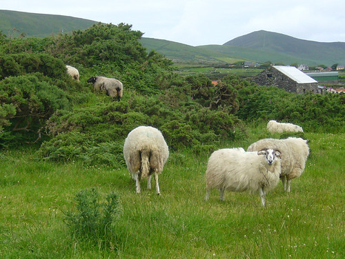
Dingle is a peninsula on the southern west coast of the island. It is located in one of Ireland's Gaeltacht regions. These are regions where the Irish language and culture are protected by the government. For many people in these regions Irish is their first language and most signage is only in Irish. There are about 10,000 people on the peninsula and about 500,000 sheep. And very few trees. Everything is very green but grows very low to the ground. And there are a lot of rocks. Its amazing to think about how anyone could have got anything to grow in the land much less cleared enough rock away to plant anything.
When my train reached the town of Tralee, just before entering the peninsula, I had to change to a bus to travel to Dingle Town on the peninsula's far coast. Once the bus left Tralee and began winding its way through the peninsula, I swear, I entered a fairy land! If this beautiful landscape was any indication of what was to come (which I learned it was) then I knew I was in for a lovely weekend (which I did have)!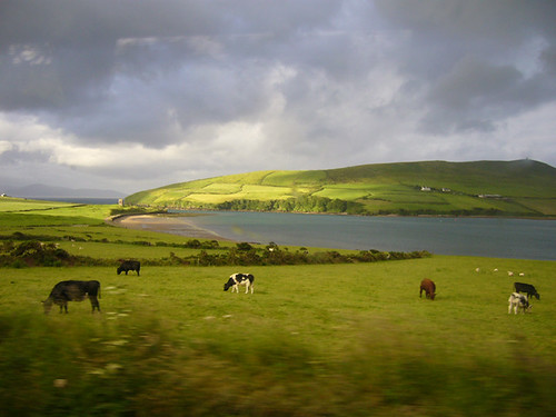
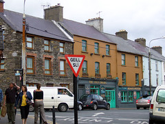
I arrived late in the afternoon, found my hostel and got my dinner at a grocery store which I ate sitting on the harbour. Dingle is a very small harbor town. Very small. I think in the three days I was there I must have walked every street in the town at least half-a-dozen times or more. The town is now mostly made up of tourists and tourist shops and restaurants. But it was charming, nonetheless.
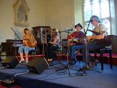
That evening I went to an concert of traditional Irish music in an old church. Apparently, the church sponsors Irish music concerts throughout the summer for the tourists three times a week. The concert was wonderful! There were two women who were from the Blasket Islands and whose parents were among those who were evacuated from the islands in 1953 (more on the Blasket Islands and why the people were evacuated in my next post!) and they sang beautiful Irish language songs and played the accordion and the Irish drum. Two men also performed playing the guitar and very complicated Irish bagpipes. I got more of my fill of Irish music!
I tried to get to bed fairly early that night because I knew I needed my rest for the next day, my birthday. I had planned a 47 kilometer (about 30 miles) bike ride around the peninsula! I rented a bike first thing in the morning and was riding out of Dingle just after 9:00 am. The ride took all day but it wasn't very difficult. I met other tourists along the route, most of them in cars. I'm so glad I did it by bike, though. It was wonderful to be out in the air (thankfully, the only sunny day I had in Ireland) and be surrounded by this incredible landscape. It also made it easy to stop and take photos and try to take it all in. I followed my Rick Steves guide book that laid out both my riding directions and the sights I would see along the way.
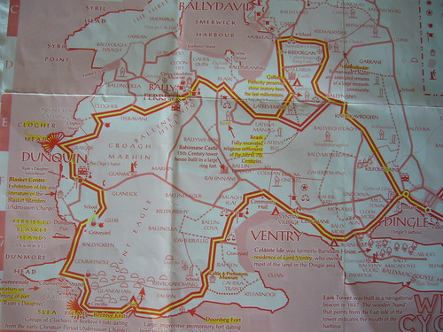
Ireland has a long and interesting history. The Celtics settled the island by 700 BC. Ireland is one of the only places in Europe that was not conquered by the Roman Empire. The Romans came, hated the cold and rainy weather, named the island Hibernia (which means "land of winter") and left. This is why the Celtic, or Gaelic, culture was able to thrive. The Christians came by 500 AD and gradually Christianized the island. In fact, Ireland was a favorite place for hermit monks to go to create isolated monasteries. Their writings helped to keep knowledge alive during the middle ages. Then, by 800 AD, the invasions started. First the Vikings, then the Normans and Ireland came eventually under control of England which only ended (expect in Northern Ireland) in 1949 with the creation of the Republic of Ireland.
So, I tell you all this so you will get a sense of how amazing the Dingle Peninsula is. Ireland's long history can be found, piece by piece, on this peninsula in the form of ruined forts, homes, churches and stone markers...and I saw many of them on my 47 kilometer bike ride! (My photos have more sights and information than I will write here, so take a look!) So...here are the sights I saw and the landscape I fell in love with...
"On my travels I do not imagine
Any splendour I saw in my time
But this jewel that was crafted of fashions
This double-width quilt of the isle."
-Sean Dunleavy, The crafted quilt of the isle
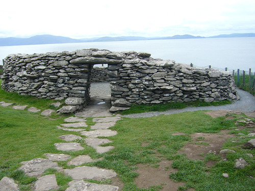
One of my first stops was at a "Fairy Fort". One of the reasons that there are still so many prehistoric and medieval sites still to be found at Dingle is that the locals were superstitious about them. Because they didn't always know what these old stone shelters and walls were, they thought they were built by fairies. And there were all kinds of bad-luck stories about the people who disturbed these fairy forts. In the nineteenth century, scholars began to excavate these forts and learn more about them. This fort, however, has yet to be excavated but is believed to have been a Celtic chieftain's home. For now, it is a grass and shrub covered mound of rocks that the sheep graze over.
My next stop was at Dunbeg Fort: a fort of ditches and rock walls that date from around 580 BC and was also used in the 8th-11th centuries AD.
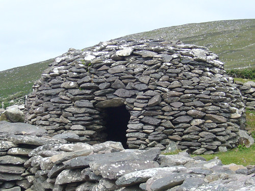
Next, I saw more ancient forts called Beehive Huts. Named for their beehive shapes, these huts were used from prehistoric times to 12oo AD. Because there are no trees and a lot of rocks, homes from ancient times to the present day were built out of rocks and no mortar was used in building these ancient shelters. They are amazing structures.
To give you an idea of how beautiful Dingle was, go out and rent a couple of movies that were filmed here: Ryan's Daughter and Far and Away. In fact, this field was used in the filming of Far and Away:
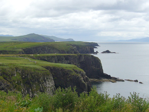
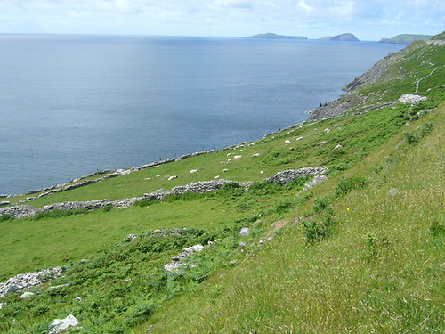
As I rode, the ocean came gradually into view and the land got more and more interesting. The rolling land would suddenly break off into great cliffs falling into the ocean. Soon, small islands a few miles out to sea came into view. I stopped for my picnic lunch of berries and a salami sandwich on the slope of Dunmore Head, a piece of rounded land jutting out from the peninsula.
After my lunch and rest I continued to the Dunquin Pier where I took the ferry boat to the Great Blasket Island, three miles out from the mainland. My Blasket experience was unexpectedly fascinating and took up much of my afternoon, so I've decided to save relating that for another day....so....back to the mainland! (Watch for my next post to read about the Blasket Islands!)
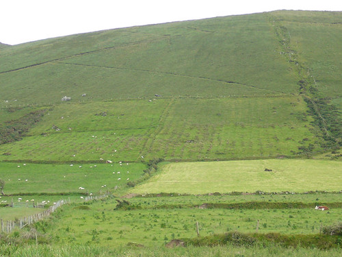
After learning about the Blasket Islands, I continued around the west edge of the peninsula, where I saw these fields going up the mountainside:
See the plow lines? These fields have not been planted since the Great Potato Famine and those plow lines are from the last planting when the potatoes rotted in the ground. Ireland was not the only place where the famine affected potato crops, but western Ireland was so hard hit because it was the only crop growing here. The rocky ground didn't allow much to flourish here but the potato. So when the crops failed, the people here had nothing else to survive on. Nearly a million people died and another million left for America, Canada and Australia. Ireland is only now recovering from this population depletion.
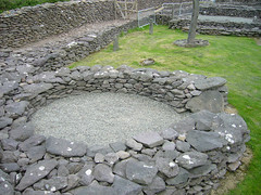
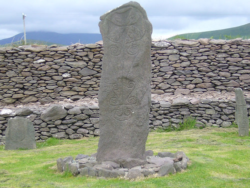
My next stop was another one of those old "fairy forts". This one was hidden in a small residential neighborhood: a mideval monastary called the Reasc Monastery. It dates back to the 6th-12th centuries. The roofs are long gone but the ring of foundation and low walls are still there and continue to be excavated and restored. The site has a large stone with ancient Celtic markings. The monks added their own Christian cross to the stone which they did with many Celtic sites...they simply adapted the Celtic culture and remains to their own needs.
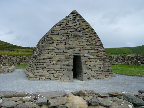
My next stop was another early Christian site: the Gallarus Oratory. This structure was built as a church. Remember, there was no lumber for building so the monks followed the local practice of building with stones without mortar...and it is still waterproof! This little church was built 1,300 years ago and is still in almost perfect condition.
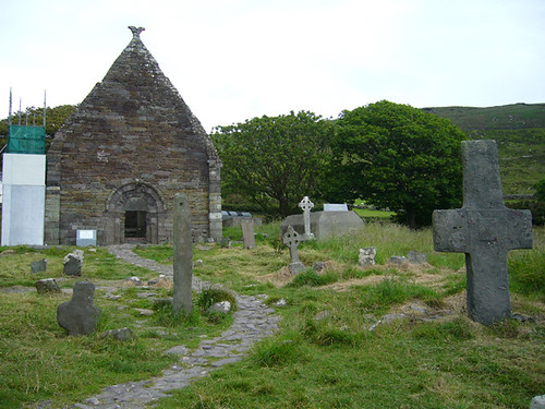
Not too far away was another early Christian church: the church of Kilmalkedar. This one dates from the 12th centuary and is not in such good condition. It's located in a graveyard, still being used by the locals. But there were other, older structures in this graveyard: a Celtic sundial and a 1,700 year old ogham stone. An ogham stone was a Celtic made stone with and ancient form of writing on it. This one was marking a grave.
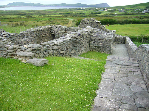
My last stop was the last of the "fairy forts" I saw that day: the Chancellor's House. This was the excavated ruins of what was beleived to be the home of a 14th century chancellor.
As I returned to my bike after exploring the Chancellor's House, it started to rain. It was just a drizzle but thankfully I had no more stops to make, just a long 4 mile bike ride home. I walked up a long hill for about a mile and then coasted downhill to Dingle for the final 3 miles and rode back into Dingle just before 9 pm, soaking wet. But oh! so happy after one of the most amazing 12 hours I've ever had the pleasure of living!
Please take a look at all of my Dingle photos...I'm amazed when I look at them that there are actually such places in the world and that I was actually there!
"No wonder men of action fought
For this green land, now in its prime
For I see by this glorious splendour
That our fair maiden wins the prize.
Lord strengthen those of the liberation
Who smashed her shackles and made her free
Lord she is all of your creation
Down to its very smallest tree."
-Micheal O'Guiheen, A beautiful morning

1 comment:
Thanks for sharing. I can't wait to make it there.
Post a Comment